The wall tells youbefore it falls.
A printed 100 mm tag, a phone photograph, and a width in millimetres you can defend in a committee room. Midmakh turns a crack into a rate — and a rate into a repair queue under a budget that will not cover everything.
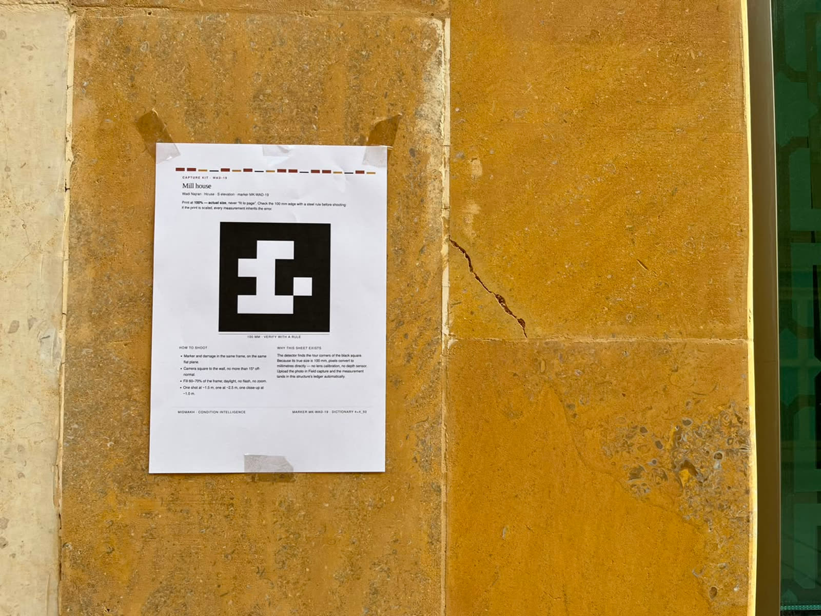
A photograph proves a crack exists. It does not tell you what to do about it.
Most inspection tools stop at detection, and detection is the easy half — a dark line in a photograph is a dark line. What a conservation officer needs is a number they can defend, a direction of travel, and an order of works that survives a budget.
A tag in the frame
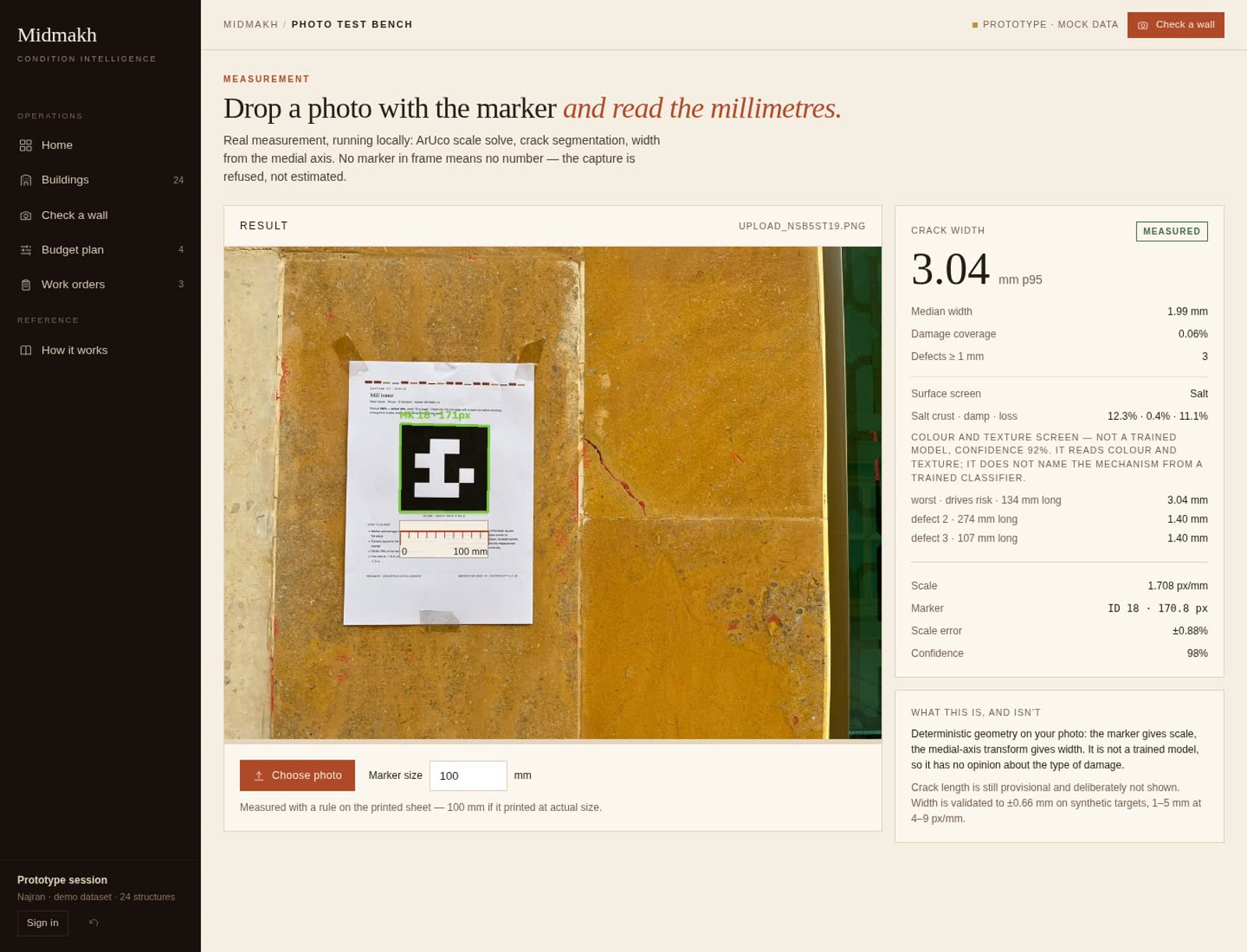
A printed 100 mm square is taped beside the damage. Its four corners are found in the photograph, so every pixel knows its physical size — with no assumption about how far away the camera was.
Geometry, not a guess
The crack is traced and its medial axis measured. Width comes from a distance transform against a known scale, not from a model that has seen other walls. The engine returns millimetres with an error bar.
Two dates make a trend
One capture is a snapshot; five are a slope. The record keeps every visit, so the question changes from “how bad is it” to “how long until it is worse than we can fix”.
A queue, not a report
Rate, exposure and structural criticality resolve into a ranked list of repairs under the money actually allocated, with the cost of deferral shown beside the cost of work.
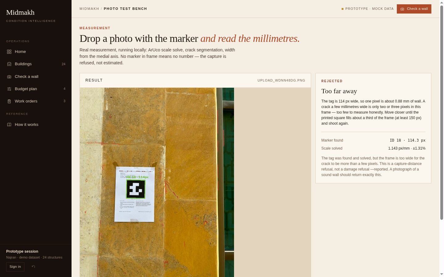
It refuses more often than a demo would.
No tag in frame. No scale, so no millimetres. The capture is rejected rather than estimated from a guess about distance.
Tag too small. At 114 px across, one pixel is 0.88 mm of wall. A millimetre figure from that frame would be a fiction, so the engine asks you to move closer.
Nothing coherent. Wall texture, joints and fittings produce dark lines too. If nothing is long and thin enough to be damage, the answer is nothing.
The operator confirms
The engine proposes a highlighted region. A human looks at it and says whether it is damage. No measurement enters the record without that decision, because a confident wrong number is worse than a refusal.
Screening is labelled
Salt crust, damp and surface loss are read by colour and texture statistics — a heuristic, reported as one. It is not a trained classifier and the interface never implies that it is.
Seven real sites. Real names, real places.
The demonstration portfolio is built on places that exist and appear in the Najran Municipality record, the Saudi Press Agency and the archaeological literature. Two construction dates are published; the rest are estimates, and the table says which is which. Condition values are illustrative — the buildings are not.
Measure the wall. Decide with the number.
The platform opens on the portfolio: twenty-four records across seven sites, ranked by how soon they fail and what it costs to wait.